Texas Weather Conditions, Radar, Forecasts
This
site is NOT a source of official forecasts and should not
be used as such. For official information, please refer to NWS and National
Hurricane Center products and websites. |
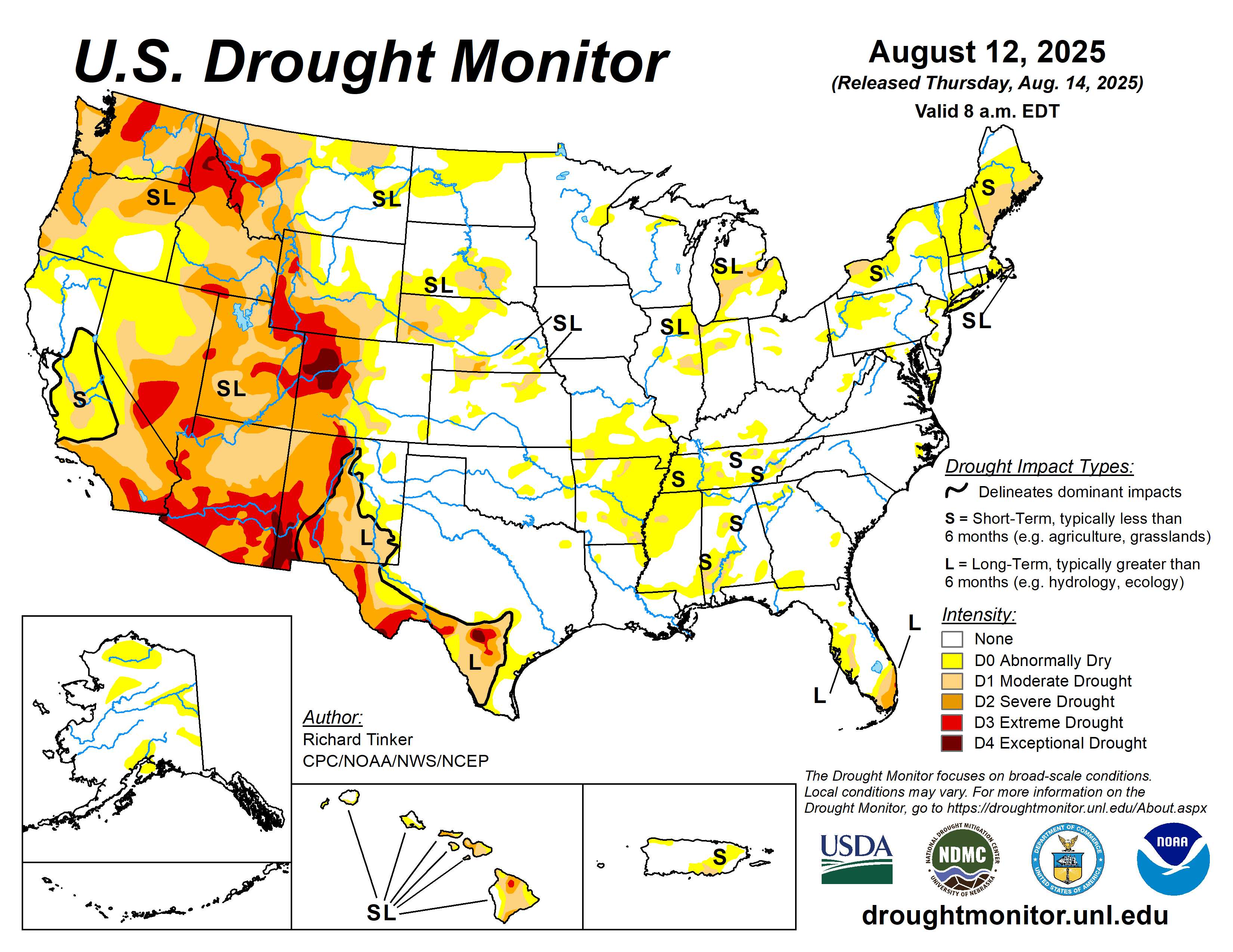
This site provides current East Texas weather conditions, weather radar, short and 10-day forecasts, weather maps, and Texas drought information.
It also provides links to official weather sites such as the National Weather Service (NWS) and the National Hurricane Center (NHC), and popular regional media outlets.
Important Texas Weather Resources |
||||||||||||
Official Weather Service Offices
Texas Media OutletsKLTV Tyler ABC Tyler Weather Houston Chronicle Weather Other Texas Weather Sources |
||||||||||||
East Texas Radar, Current Weather Conditions, and Forecast
Typical Texas Weather Patterns and Climate
Because of its size, spanning over 800 miles both north to south and east to west, Texas has a wide range of climatic conditions over several diverse geographic regions. Texas' weather varies widely, from arid in the west to humid in the east. The huge expanse of Texas encompasses several regions with distinctly different climates: Northern Plains, Trans-Pecos Region, Texas Hill Country, Piney Woods, and South Texas.
The Gulf of Mexico is the predominant geographical feature affecting the state’s climate, moderating seasonal temperatures along the Gulf Coast and providing the major source of precipitation for much of the state
East Texas receives more rainfall, 35 to 60 inches, than other areas of Texas, and humidity and temperatures are typically high.
All of East Texas has the humid subtropical climate typical of the Southeast USA, with sporadic intrusions of cold air from the north during winter months.
Hurricanes in Texas
The State of Texas has the second-most hurricanes affecting it, only behind Florida. Recorded storms impacting Texas date back to 1527. Since 1851, 66 hurricanes have affected the state of Texas. This includes direct landfalls and indirect impacts.
The most active hurricane month is September, with 21 total storms, while no recorded storms have affected Texas during the months of December through May. The deadliest hurricane was the 1900 hurricane that hit Galveston, costing the lives of 8,000 residents. The most intense storm in terms of barometric pressure was Hurricane Allen in 1980. Hurricane Harvey in 2017 dumped 60.58" of rain on Nederland.
Saffir-Simpson Hurricane Wind Scale
A Tropical Depression is a tropical cyclone in which the maximum sustained surface wind speed is 38 mph or or less.
A tropical cyclone is named as a Tropical Storm when its wind reaches 39mph sustained.
A cyclone reaching 74mph is classified as a Hurricane.
The Saffir-Simpson Hurricane Wind Scale is a 1 to 5 rating based on a hurricane's sustained wind speed. This scale estimates potential property damage. Hurricanes reaching Category 3 and higher are considered major hurricanes because of their potential for significant loss of life and damage.
| Category | Strength in MPH |
| 1 | 74-95 |
| 2 | 96-110 |
| 3 | 111-129 (Major) |
| 4 | 130-156 (Major) |
| 5 | 157 or greater (Major) |
Hurricane Naming and Retired Hurricane Names
In 1953, the United States began using female names for storms. Beginning in 1979, male and female names were included in lists for the Atlantic Ocean basin and the Gulf of Mexico. View a list of retired hurricane names at the National Hurricane Center (NHC)
Shown below are the names for Atlantic hurricanes in 2023-2028.

Tornadoes in Texas
An average of 132 tornadoes occur in Texas each year. According to the National Oceanic and Atmospheric Administration (NOAA), about 9,700 tornadoes have been recorded in Texas since 1950. Tornadoes occur with greatest frequency in the Red River Valley of North Texas. These storms may occur in any month and at any hour of the day, but they occur with greatest frequency during the late spring and early summer months.
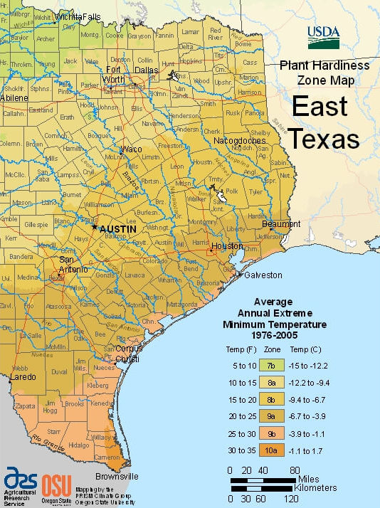
USDA Plant Hardiness Zones for East Texas
Weather patterns and temperatures play an important part in growing vegetables at home and crops in farms. Shown below is the USDA Plant Hardiness Zones for East Texas.
 |


