More Attractions |
State Parks in East Texas
East Texas is home to a wide variety of state parks, from Upper East Texas down to the Gulf Coast.
Included on this page are highlights of some of the more popular state parks across this part of Texas.
Whether you are touring in Deep East Texas, around Nacogdoches, or in Upper East Texas in the Tyler, or elsewhere in the area, there are a variety of state parks of interest to everyone.
For more information, maps and facilities at State Parks in East Texas, visit the website of Texas Parks and Wildlife
Atlanta State ParkAtlanta State Park sits on the shores of Wright Patman Lake in the far northeast corner of Texas. Towering pines and hardwoods shade the park, providing fall and spring color, and beauty year-round. At Atlanta State Park, visitors can fish, boat, water-ski and swim at a designated area (no lifeguard on duty). Ashore, you may walk, study nature, bird, camp, picnic, geocache, and jog or hike along roads, trails and shorelines. Explore hilly park roads on your bicycle. Fishermen enjoy this 33,750-surface-acre reservoir (and its 75-pound catfish). The park has two boat ramps and a fish cleaning station. To find out more about fishing here, visit the Wright Patman Lake page. The park offers 4.8 miles of hiking trails, including an .8-mile nature trail. Campers can reserve one of 58 campsites. All sites have water and electricity; 14 of them have sewer hook-ups, too. The picnic pavilion and an amphitheater can be reserved for group events. It is located at 927 Park Road 42. Phone 903.796.6476
|
Tyler State ParkTyler State Park is located just north of Tyler, 2 miles north of Interstate 20 on FM 14, then into the park on Park Road 16. This beautiful 985 acre park in the rolling hills features a 64 acre lake, campgrounds, hiking trails, pavilions, cabins, mountain biking, nature studies, canoes, paddle boats, kayaks, bike boats, jon boats, park store and much more. At Tyler State Park, you can boat, fish, swim in the lake, hike, mountain bike, picnic, geocache, camp, bird watch and study nature. Explore the Pineywoods on more than 13 miles of trails. Don’t miss the Whispering Pines Nature Trail, laid out more than 70 years ago by the Civilian Conservation Corps.
|
Lake Bob Sandlin State ParkLake Bob Sandlin is located on Big Cypress Creek 5 miles southwest of Mount Pleasant in Titus, Camp, and Franklin counties. It has a surface area of 9,004 acres, and a maximum depth of 65.6 feet. It was impounded in 1977. Lake Bob Sandlin State Park is a 639.8-acre park located on the heavily wooded shoreline on the north side of Lake Bob Sandlin.
|
Martin Creek Lake & State ParkMartin Creek Lake is located in Rusk County, on Martin Creek 3 miles southwest of Tatum on Texas Highway 43. It covers a surface area of 4,981 acres, with a maximum depth of 35 feet. The lake was impounded in 1974 to provide cooling water for a power plant. Since Martin Creek is a power plant lake, water temperatures are elevated, especially during the winter months. Anglers are most successful at catching largemouth bass during the winter and early spring. Martin Creek Lake State Park, which consists of 286.9 acres, is located in the area.
|
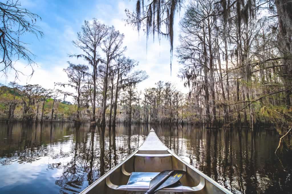
Caddo Lake State ParkCaddo Lake is a 25,400 acre lake and wetland on the border between Texas and Louisiana, in northern Harrison County and southern Marion County in Texas and western Caddo Parish in Louisiana. This lake was the only natural lake in Texas until it was artificially dammed in the early 1900s when oil was found and for flood control in 1914. A new dam replaced the old one in 1971. Some of the cypress trees in the swamp are more than 400 years old. The average depth of the lake is 8 to 10 feet with the deep water in the bayou averaging about 20 feet. The lake contains 71 species of fish, and it is especially good for crappie and largemouth and white bass. The denseness of the swamp creates an inviting maze for paddlers in kayaks and canoes. On the Texas side, at Caddo Lake State Park, there are 10 kayak/canoe trails, with names like Hell's Half Acre, Cathedral Trail, Old Folks Playground and Turtle Shell Trail. The trails are marked, and maps are provided. For more information on the park, located at 245 Park Road 2, Karnack, TX, phone 903.679.3351 Quiet scene from a canoe at Caddo Lake State Park in Texas (Photo by Jamie Hudson - Travel Texas) |
Daingerfield State ParkDaingerfield State Park, in Morris County southwest of Texarkana, is a 506 acre recreational area, and includes the 80 acre Lake Daingerfield. The park features the Rustling Leaves Nature Trail, camping, fishing, hiking and more, all nestled in colorful groups of maples, gums and oaks. |
Cooper Lake State ParkThe City of Cooper is the county seat of Delta County, in Upper East Texas. It is located between the north and south forks of the Sulphur River. The city lies south of Paris, Texas, and north of Sulphur Springs, on Texas State Highway 154 and FM 64. Jim Chapman Lake, also known as Cooper Lake, is the most popular tourist attraction in the area, offering visitors boating, swimming, and fishing. Along the north shore of the lake is the Doctor's Creek Unit of Cooper Lake State Park. The park contains several picnic areas, campgrounds, and a large swimming area. The park also contains several hiking and equestrian trails.
|
Mission Tejas State ParkMission Tejas State Park is located midway between Dallas and Houston, at the north end of the Davy Crockett National Forest. The park features fishing, camping, and 8.5 miles of hiking trails through tall pines and past historic places such as the El Camino Real. The park is located at 19343 State Highway 21 East in Grapeland TX 75844 |
Village Creek State ParkVillage Creek State Park’s 1,090 heavily forested acres are located in the Hardin County town of Lumberton, 10 miles north of Beaumont. The state acquired the property in 1979, and the park opened in 1994. Village Creek State Park takes its name from Village Creek, a free-flowing stream that rises near the Alabama-Coushatta Indian Reservation. The creek meanders 69 miles southeast to a junction with the Neches River. The river in turn eventually empties into the Gulf of Mexico. Village Creek is a very popular flat-water canoeing stream in the heart and soul of what remains of the Big Thicket. Heavy rainfall severely floods the banks of Village Creek every three or four years. Here visitors can camp, picnic, fish, hike, mountain bike, swim, geocache, study nature and view wildlife. A covered picnic pavilion can also be rented for group gatherings. Portions of the park lie in the floodplains of Village Creek and the Neches River. Bottomland hardwood forests full of cypress-tupelo swamps, baygall and backwater sloughs abound here. These wetlands provide habitat for beaver and river otter, as well as for many kinds of fish, snakes, turtles and frogs. Birders will enjoy seeing wood ducks, egrets, herons, woodpeckers and owls, just to name a few. Over 200 species of birds are native to the Big Thicket area. It is located at 8854 Park Road 74 in Lumberton.
|
Martin Dies, Jr. State Park
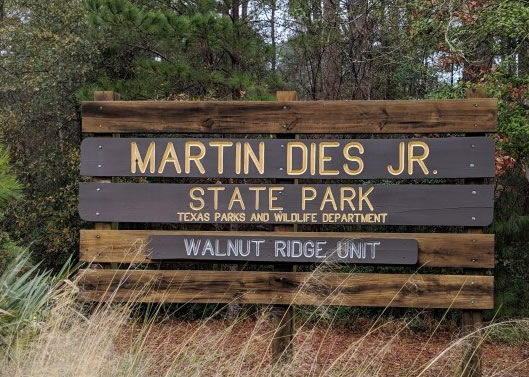
In the 1960s, development of a new state park along the B.A. Steinhagen Reservoir began, with support from local East Texans and their state senator, Martin Dies, Jr. Today, Martin Dies, Jr. State Park is a 705-acre recreation area nestled next to B.A. Steinhagen Reservoir between Woodville and Jasper. The park has three units in Jasper and Tyler counties. TPWD leased the park’s land from the U.S. Army Corps of Engineers in 1964, and officially opened in 1965. The park offers a variety of outdoor activities, including camping at over 200 campsites, paddling, fishing, swimming, hiking, biking and more. The park is located at 634 Park Road 48 South, Jasper, TX 75951
|
Sabine Pass Battleground State Historic ParkThe location of a significant Civil War battlefield, Sabine Pass Battleground State Historic Site tells the story of Confederate Lt. Richard “Dick” Dowling and his 46 men who thwarted an attempted Union attack on Sabine Pass, a primary Texas port for Confederate shipments of supplies and vital to the war effort. Located at 6100 Dowling Road in Port Arthur.
|
Sea Rim State ParkOffering more than five miles of natural Gulf of Mexico beach shoreline, Sea Rim State Park is where the marsh meets the surf, making it prime binocular-hunting grounds for numerous species. Bring a kayak or canoe (or rent one at the park) and paddle along one of its paddle trails, or comb the sand for sea treasures that wash up on the shore.
|
More About State Parks in Texas
State Parks website at Texas Parks & Wildlife
Map and Details of All Texas State Parks
Reservations at Texas State Parks
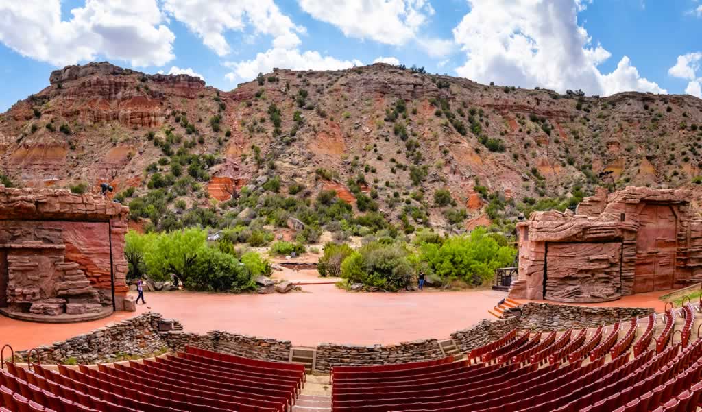
Palo Duro Canyon State Park in Texas (Photo by Jamie Hudson - Travel Texas)
Fall Colors at Texas State Parks
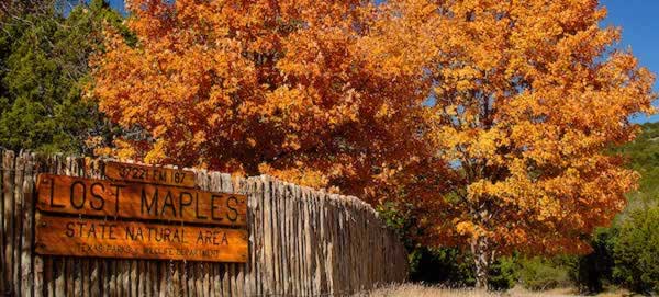 Fall scene at Lost Maples State Natural Area (Photo courtesy of Texas Parks & Wildlife) |
The State of Texas offers dozens of excellent state parks, many in wooded areas that feature acres of vivid fall colors.
Beyond the popular bigtooth maples of Lost Maples State Natural Area, you'll find fall foliage in many state parks. Visit gorgeous yellow cottonwoods at Caprock Canyons. Enjoy the many East Texas hardwoods including elms, oaks, sweetgums, beeches and hickories at state parks like Lake Bob Sandlin, Cooper Lake, Martin Creek Lake and other locales.
For more information on fall activities in Texas State Parks, visit "Fall for Parks" at the website of Texas Parks and Wildlife
National Parks in Texas
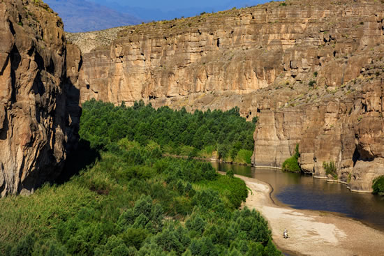
| Big Bend National Park (Photo by Chris Zebo - Travel Texas) |
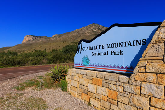
Guadalupe Mountains National Park (Photo by Chris Zebo- Travel Texas) |
 |
 |
| Big Bend website at NPS | Guadalupe Mountains website at NPS |
|
  |
Big Thicket National Preserve Traveler reviews and photos at TripAdvisor |
